← Tuesday, October 6, 2026WebTool
A browser app finds routes that trade distance for less climbing in San Francisco
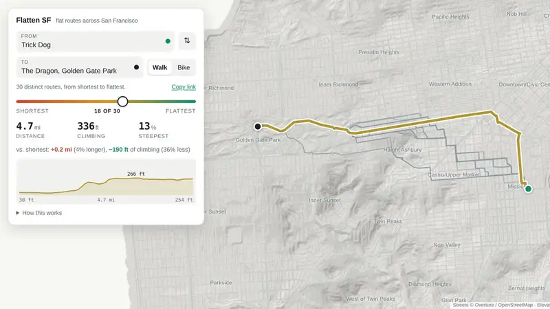
The app computes routes over 160,000 street segments using lidar elevation and OpenStreetMap data, with a slider for trading distance against climbing. It is a useful example of substantial route computation and data working in the browser.
- What
- Flatten SF is a browser app that finds walking and biking routes trading distance against climbing.
- How
- It computes routes over 160,000 street segments using USGS 1 m lidar elevation and the Overture / OpenStreetMap street graph.
- Why it matters
- The trade-off slider exposes routes that are not beaten on both distance and climbing, helping engineers reason about multi-objective routing.
Read on flattensf.com → Hacker News · 61 comments
Discussion
Discussion is not switched on yet. Use Note above to keep your own thoughts on this story.
Headline, summary, brief and diagram are written by a model from the source's own text; the link, byline and numbers come from the source. Read the original before relying on a claim.